Surface Hydrology

About:

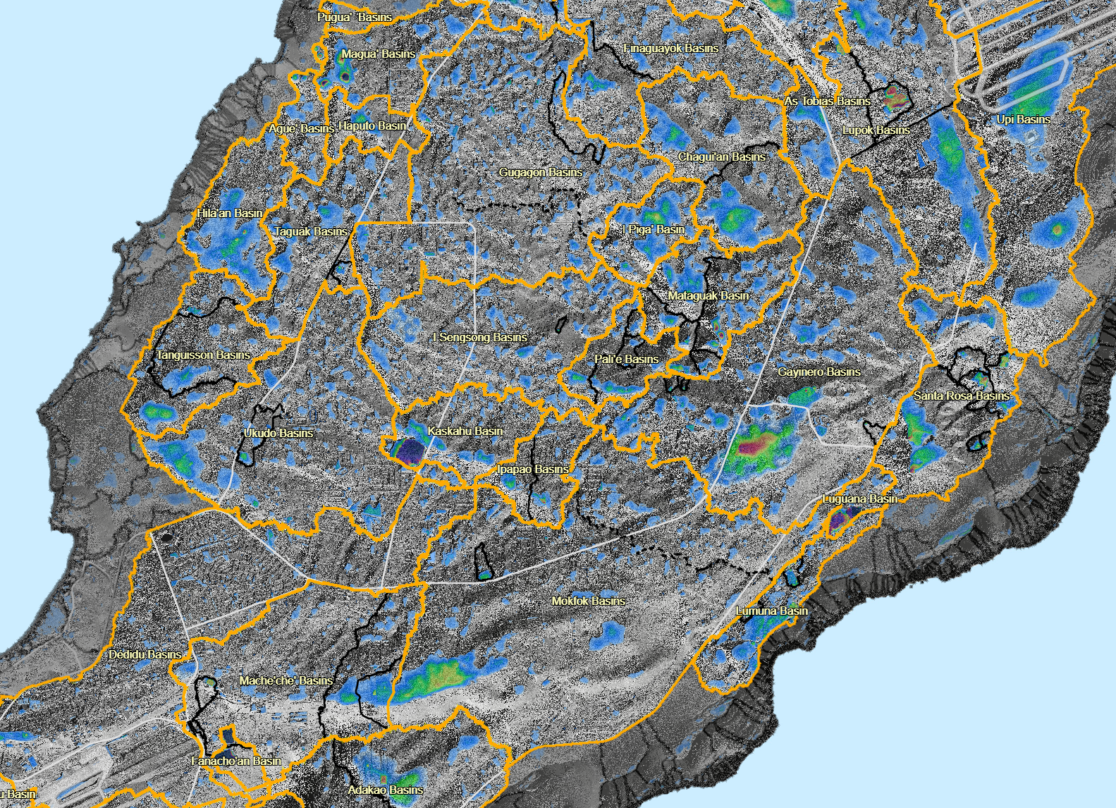
This map shows the plateau basins with their CHamoru names.

LiDar Imagery version:

https://guamhydrologicsurvey.uog.edu/index.php/2022/01/14/surface-hydrology-lidar-imagery/

Updates:

Last updated in 2021.

Deskop view:

https://werinch2018.maps.arcgis.com/apps/webappviewer/index.html?id=7f506c88a95747aa8774b0c0d311d7da

Shape Files:

Plateau basins and internal basin boundaries (based on digital elevation model 2012)


Maps by Organizations Browse

Water & Environmental Research Institute of the Western Pacific

Guam Bureau of Statistics & Plans

Kumisión I Fino’ CHamoru

Federal Emergency Management Agency

Latest Maps Browse

Back to top

Our site uses cookies. By using this site, you agree to the Privacy Policy and Terms of Use.