
Developers
MW Zapata, DK Valerio, & NC Habana
Developers
MW Zapata, DK Valerio, & NC Habana
About
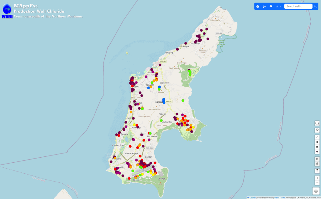
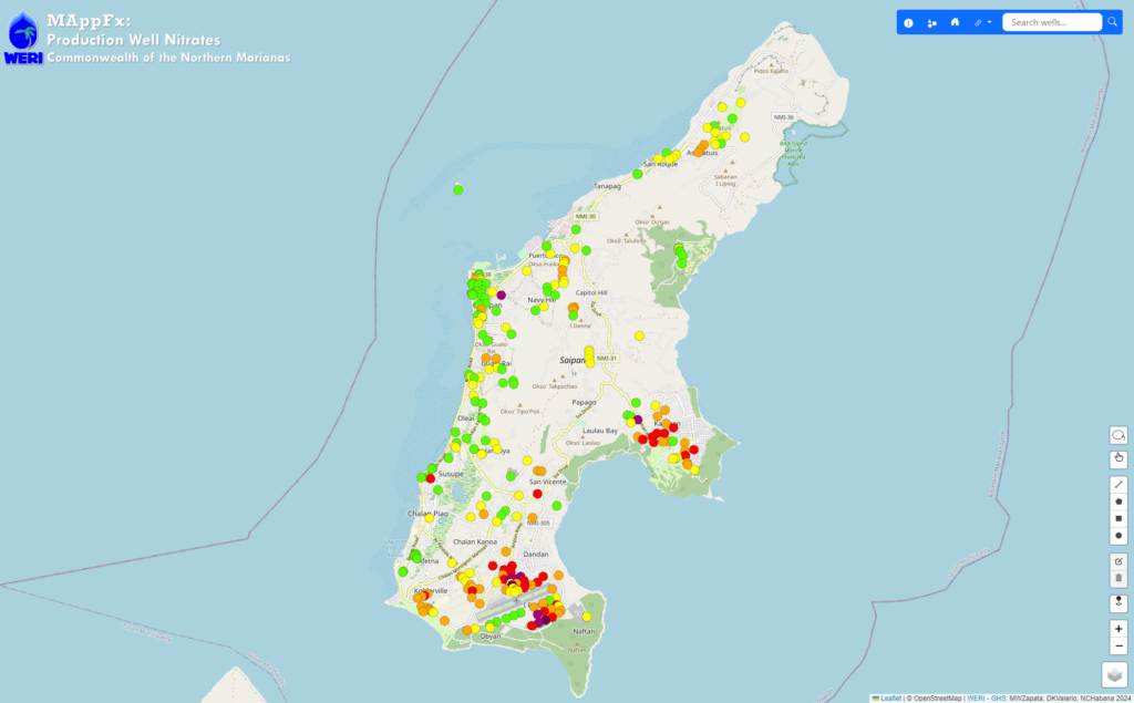
Two MAppFx products were created for Saipan, CNMI using the production well nitrates and chloride data, respectively. The WERI GHS IM team developed a system to organize the raw data, an Excel file, and convert it into a JSON file as an input into the MAppFx interface. The map features an interactive map of Saipan with production wells as the points of survey. Each well is color coded based on a system of values provided by the Saipan BECQ team and can be toggled on and off through the map’s legend and layer control widget. Its graphs display available data for the site that users can also interact with.
It essentially takes on the same codebase as the Chloride and Production MAppFx for Guam, but with a new selection feature, which was requested by the Saipan BECQ team. This selection tool allows for the user to select multiple wells and view all the graphs in one pane. Having this view helps provide a summary when comparing data between select wells in different regions. To trigger this tool, the user would select the lasso widget towards the bottom right of the screen. This MAppFx was presented at the WERI Advisory Council Meetings and was met with positive reception from the audience.
Data
Data originated from Bureau of Environmental and Coastal Quality’s Data Manager and Team. Through a collaborative effort, the GHS Information Management Team created this online data visualization tool to facilitate modern means of data sharing and interagency outreach. The primary focus of this tool is to use nitrates as an indicator of groundwater contamination, making it an essential resource for environmental monitoring.
