Nitrate-N and Sources

About:

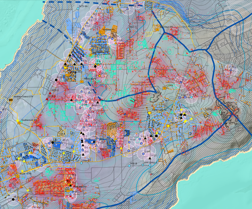
This map illustrates the nitrate concentrations in production wells. The contents of this analysis overlays the map of the Northern Guam Lens Aquifer (NGLA).

Updates:

Last updated in 2021.

Desktop view:

https://werinch2018.maps.arcgis.com/apps/webappviewer/index.html?id=7c8d643f3b6f4e31bd03d236468ba484

Shape Files:

Basement topography | Elevation contours, meters, Vann, Bendixson, Habana 2018

Basement contours | Select contours 0, -20, -40 meters

Parabasal zone 2014

Saltwater toe extracted from groundwater model | No pumping, 50% isochlor, Gingerich 2014

Aquifer basins 2021 | Basement and flow line delineation, from Gingerich 2013 model

Water table contours | No pumping condition, from Gingerich 2013 model

NGLA Map 2021 | Basic shapefiles package

Maps by Organizations Browse

Water & Environmental Research Institute of the Western Pacific

Guam Bureau of Statistics & Plans

Kumisión I Fino’ CHamoru

Federal Emergency Management Agency

Latest Maps Browse

Back to top

Our site uses cookies. By using this site, you agree to the Privacy Policy and Terms of Use.